
2,190 Lightning Strikes Spark Wildfires Across Oregon
Oregon has recorded 2,190 lightning strikes over the last fortnight, fueling wildfires across Southern, Central and Eastern areas of the state where nearly 800,000 acres are in flames.
There are now 38 wildfires throughout the state, with the largest being the Durkee Fire in Baker County where none of the 239,734 acres under flame has been contained.
Weather Conditions Do Not Favor Firefighters
Today’s weather will not favor firefighters who are expected to face gusty wind conditions, says the Oregon Department of Forestry on its website.
Two significant lightning strikes on Wednesday evening two weeks ago sparked the fires, and by the time those weather conditions ended four days later, multiple fires had erupted across the state, especially in Central and Eastern Oregon where fires spread uncontrollably within a 12-24-hour period, according to the ODF.
Oregon experienced 632 lightning strikes within 24 hours over the last week, and a dry lightning weather alert remained effective until yesterday (Tuesday). Apart from gusty winds, the ODF is expecting better weather conditions over the next few days, with thunderstorms predicted over southeast Oregon.
Six Major Wildfires Consume 732,317 Acres
Six of Oregon’s major fires are consuming 732,317 acres of private and public forestland. They are:
- Durkee Fire, Baker County: 239,734 acres, 0d% containe
- Falls Fire, Harney County: 139,507 acres, 40% contained
- Cow Valley Fire, Malheur County: 133,490 acres, 91% contained
- Lone Rock Fire, Gilliam County, 131, 598 acres, 40% contained
- Monkey Creek Fire, Morrow County, 48,342, 0% contained
- Bone Yard Fire, Grant County, 39,647 acres, 3% contained
According to the ODF, the Bone Yard Fire is burning out of control. It is in the Wall Creek drainage, north of the small eastern town of Monument, in Grant County, where fire crews are battling 90 wildfires.
Fire crews are also battling to extinguish the Durkee Fire in Baker County, where 0% has been contained.
The Falls Fire, northwest of Burns in Harney County, is spreading due to 25 mph winds, but firefighters have managed to contain 40% of the area.
The Cow Valley Fire in Malheur County is now 91% contained after burning 128,000 acres of grazing land since July 11.
Most of the fires are clustered within 30-miles north of Crater Lake. While the fires are small, a Level 3 GO NOW evacuation alert was ordered on Monday for the Microwave Tower Fire, south of Hood River and east of Mosier.
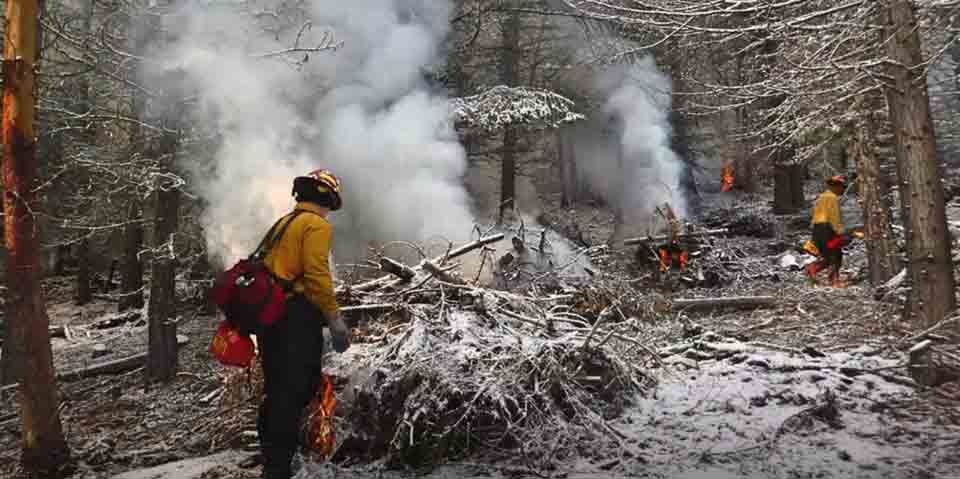
ODF Appeals to Oregonians to Help in the Fight
The ODF says its resources are strained and has appealed to Oregonians to prevent human-caused fires to allow them to ‘focus on detecting, assessing and suppressing new lightning-caused fires.’
Use the Wildfire Tracker Map as well as the ODF website for statistics and updates on wildfires in the state.