Oregon Wildfire Hazard Maps Classify 1.9 Million Taxable Properties in a Wildland Urban Interface

To tackle the challenges of wildfires, several Oregon state agencies are working with local and federal partners to protect residents and landscapes.
Residents in properties identified as high-hazard areas in the wildland-urban interface will have to play their part in meeting the wildfire challenges. They will be responsible for meeting enhanced defensible space standards and home-hardening codes.
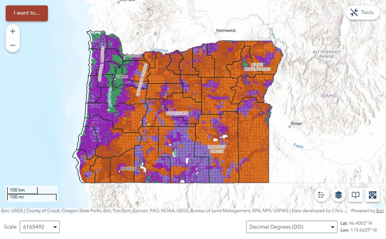
The Oregon Department of Forestry (ODF) has uploaded statewide maps that depict wildfire hazard zones. The maps are available to residents and organizations on the Oregon Explorer website.
Maps Developed in Liaison with Oregon State University
The wildfire hazard maps have been developed in liaison with Oregon State University to educate residents about wildfire exposure and will assist in prioritizing the most vulnerable wildfire areas. The maps also identify defensible space and fire-hardening standards.
Residents can find the hazard classification of their properties and identify if it is in the wildland-urban interface by using the address search function on the Oregon Explorer website.
Residents can also visit the Oregon Statewide Wildfire Hazard Map and Oregon Wildfire Programs. For more information.
The statewide wildfire hazard map divides Oregon’s 1.9 million taxable properties into three zones – low, moderate and high – and shows if they are situated within the wildland urban interface.
Oregonians who live in properties in high-hazard zones and within the wildland urban interface, could face meeting both home-hardening building codes and future defensible space code requirements.
They will soon be receiving a certified mail packet containing designation information explaining which codes may apply to their properties. Residents will also receive information regarding their rights to appeal.
Prolonged Wildfire Seasons Prompted Need for Increased Preparedness
The need for increased wildfire preparedness was prompted by fire seasons becoming longer and increasingly challenging. As the state population grows, more people live in or near forests, rangelands, and other landscaped identified as the Wildland-Urban Interface.
The Oregon State Fire Marshal (OSFM) has been mandated to adopt statewide minimum defensible space standards as set out in Senate Bill 762 that will provide more than $220 million to improve and modernize wildfire preparedness.
The wildfire hazard map has been developed by scientists at the Oregon State University and includes the best available science and data provided by more than 50 fire and fuel professionals statewide.
